
When the Map Is Wrong
Why Amateurs Keep Seeing What Professionals Miss

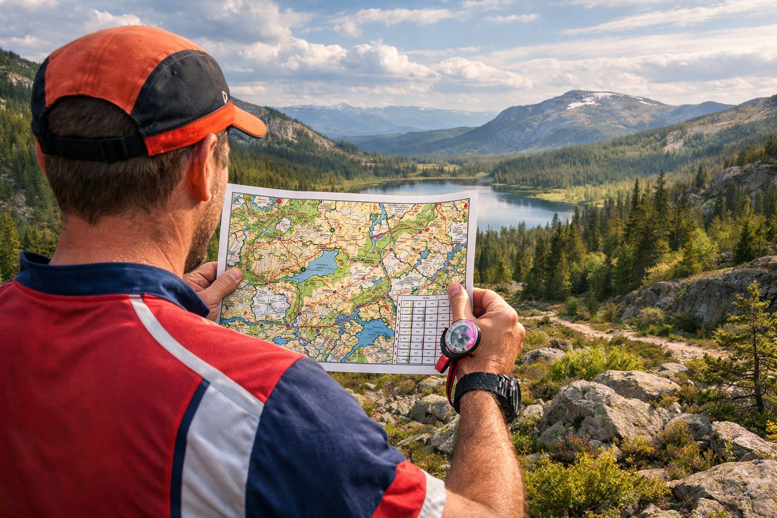
Back when I was about 17, my high school arranged for a group of us to travel to Norway, where we were hosted by the Norwegian army.
One day, we were sent off into the forest with a map and a compass. Our task was simple enough… reach a certain spot, then find our way back to base.
Before we set off, a Norwegian army officer gave us some final advice.
He said, “If at any point the land and the map disagree, the land is always right.”
It sounds obvious when you hear it. Almost trivial.
But as soon as he said it, I could almost feel a physical kerchunk in my head - like my brain had just reset to a new operating system.
I’ve since realized this is one of the most subversive ideas you can carry around with you.
Especially now.
Because we live in a world that is completely in love with maps.
Frameworks.
Models.
Best practices.
Playbooks.
Credentials.
We’re surrounded by explanations of how things should work, often delivered with great confidence by people who are very good at reading the map.
And yet… reality keeps doing its own thing.
A Time When the Land Mattered More
For a long stretch of history, discovery didn’t belong to institutions. It belonged to people with time, curiosity, and a willingness to pay attention.
Amateurs.
Dilettantes.
Gentleman scientists.
Working-class fossil hunters.
Obsessive tinkerers.
They didn’t have permission. They didn’t have credentials. They didn’t have a shared map telling them where not to look.
So they looked anyway.
They trusted what they observed. What they could measure. What they could hold in their hands or see with their own eyes. When something didn’t make sense, they didn’t assume they were wrong. They assumed there was more to learn.
Before science had formal maps, it had explorers.
And explorers, by definition, spend most of their time off the map.
How the Map Took Over
Then came scale.
The Industrial Revolution didn’t just change how things were made. It changed how knowledge itself was organized. To coordinate at scale, we needed shared systems. Categories. Standards. Institutions.
The map became essential.
This was a huge win in many ways. Modern science, medicine, and engineering don’t exist without it. Peer review matters. Training matters. Shared language matters.
But something subtle happened along the way.
The map stopped being a tool and started becoming an authority.
And once careers, funding, and reputations depend on the map, questioning it becomes risky. Anomalies get smoothed over. Outliers get ignored. Data that doesn’t fit is treated as noise.
When the map and the land disagree, it becomes tempting—very tempting—to assume the land must be wrong.
Why Amateurs Still See Things First
This is where amateurs keep sneaking back into the story.
Not because they’re smarter. Not because they’re more virtuous. But because they’re free in a way professionals often aren’t.
They don’t have sunk costs in the existing map. They’re not defending a framework they built their identity around. Being wrong doesn’t threaten their livelihood.
They can say things like, “This doesn’t match what I’m seeing,” without setting off internal alarms.
That’s a real advantage.
When your job depends on the map, the land can feel like a threat. When your curiosity is the only thing at stake, the land becomes an invitation.
This is why so many interesting insights—about markets, technology, health, culture—still come from people operating just outside the official lines. People who notice small mismatches and refuse to explain them away too quickly.
The Problem With Trusting the Land Alone
It’s tempting to romanticize this. To imagine a return to some pure age of discovery powered entirely by intuition and backyard experiments.
That doesn’t work either.
The land is always right, but it doesn’t scale very well.
Maps are how we coordinate. They’re how millions of people work together without constantly rediscovering the same ground. Without them, everything fragments.
The tension isn’t between maps and land. It’s between forgetting what maps are for—and mistaking them for reality itself.
The real challenge is keeping the two in conversation.
The Guerrilla Cartographer
This is where I think a new role is emerging—one that fits the Dangerous Little Gods temperament almost perfectly.
Think of it as the guerrilla cartographer.
Someone who knows how to read the map, but doesn’t mistake it for the territory. Someone willing to step off it deliberately, to see where it no longer matches the ground beneath their feet.
They look for anomalies. Edge cases. Lived experience that doesn’t fit the prevailing narrative. They ask naïve questions that feel slightly uncomfortable in professional settings.
Not to tear the map down—but to update it.
Today, this role is amplified by tools our amateur predecessors could only dream of. Access to data. Access to research. Access to AI that can simulate, compare, and explore at ridiculous speed.
The digital dilettante is back—not as a rebel without tools, but as an explorer with leverage.
A Simple Way to Practice This
You don’t need a manifesto to start.
Just try this, occasionally.
Take a framework you rely on. A model you trust. A set of best practices you rarely question. Then, for a moment, set it aside.
Go look at the land.
Talk to real people instead of summaries. Revisit raw data instead of dashboards. Read the original source instead of the interpretation. Ask a question that starts with, “What if this assumption is wrong?”
Treat it like play, not rebellion. Temporary. Curious. Low-stakes.
You’re not abandoning the map. You’re checking your bearings.
Trusting Reality Again
There’s a phrase for this that sounds more academic than it needs to be: epistemic de-professionalism.
All it really means is this: being willing to suspend status, certainty, and expertise long enough to notice what’s actually happening.
It’s not anti-expertise. It’s not anti-science. It’s not anti-system.
It’s a reminder that maps age, models decay, and reality keeps moving.
Dangerous Little Gods don’t reject maps. They just remember to look up from them now and then.
Because when the map and the land disagree, the land is still there.
And it’s trying to tell you something.
Bravo, Nick. This is a thought-provoking essay.
I love this. It fits perfectly with my way of thinking.